As this is my last Tuesday in Pau I signed up for a guided walk put on by the Tourist Office. It was my third visit to Lescar this year, or fourth if you count Decathlon on the outskirts, but there are still fresh delights to discover and more to learn about those I already knew. I bought snd stamped a Carnet de Pèlerin from the Tourist Office in preparation for my next Camino.
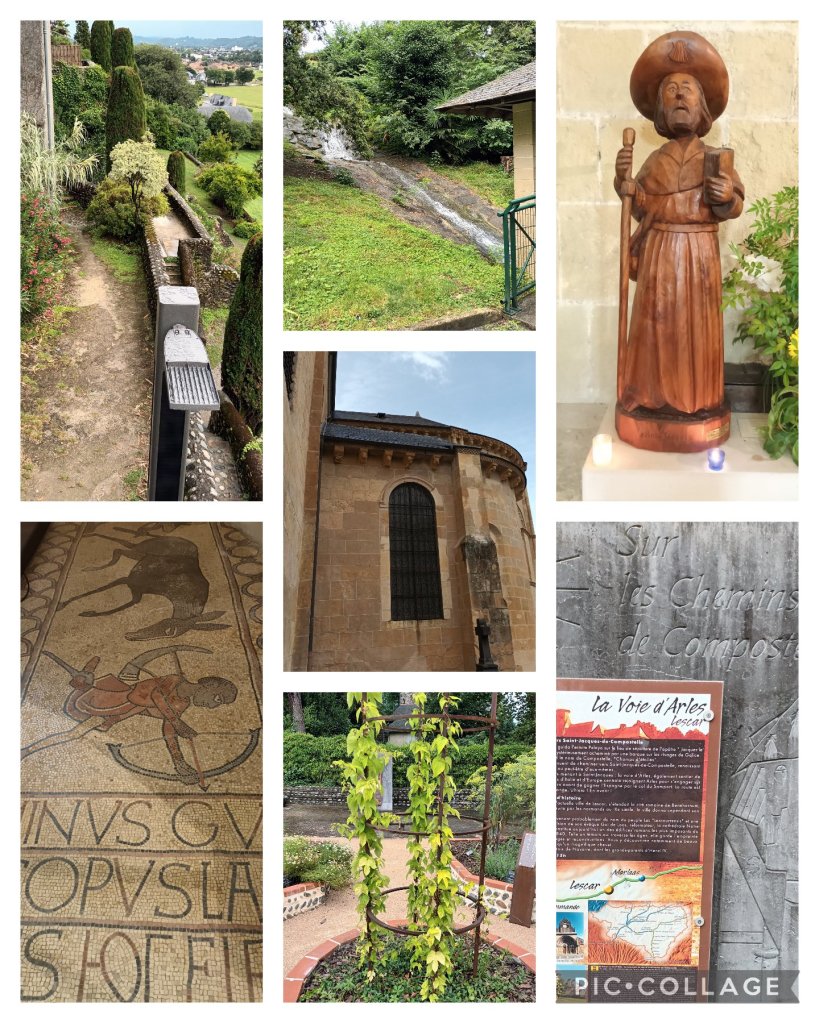
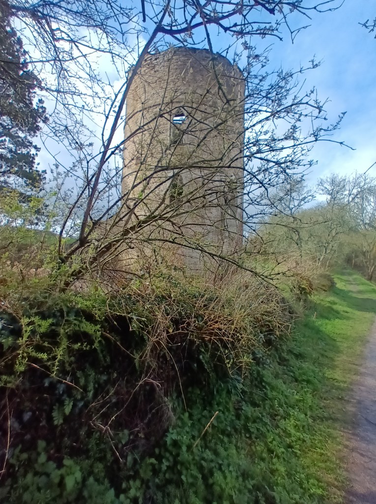
The Romans founded a city here in the first century. Parts of the ramparts (top left) date from the Vth century, and the establishment of a cathedral from the early VIth, a century earlier than the first English dioceses. The current Cathedral was built in the XIth and XIIth centuries, though the crypt and cloister disappeared when the kingdom of Béarn became Protestant. The mosaic floor (bottom left) shows a Moorish hunter with an artificial leg, the earliest example of a prosthesis in European art). A garden in the medieval style (bottom centre) has been constructed by the ruins of the Bishop’s Palace (later a prison with an impressive oubliette), and contains a reminder that Lescar lies on the Voie d’Arles, one of the four mediaeval routes to Santiago crossing France (bottom right). Below the garden, steps descend to the valley of the Lescourre (top centre), which I had time to explore before catching a bus back to Pau.
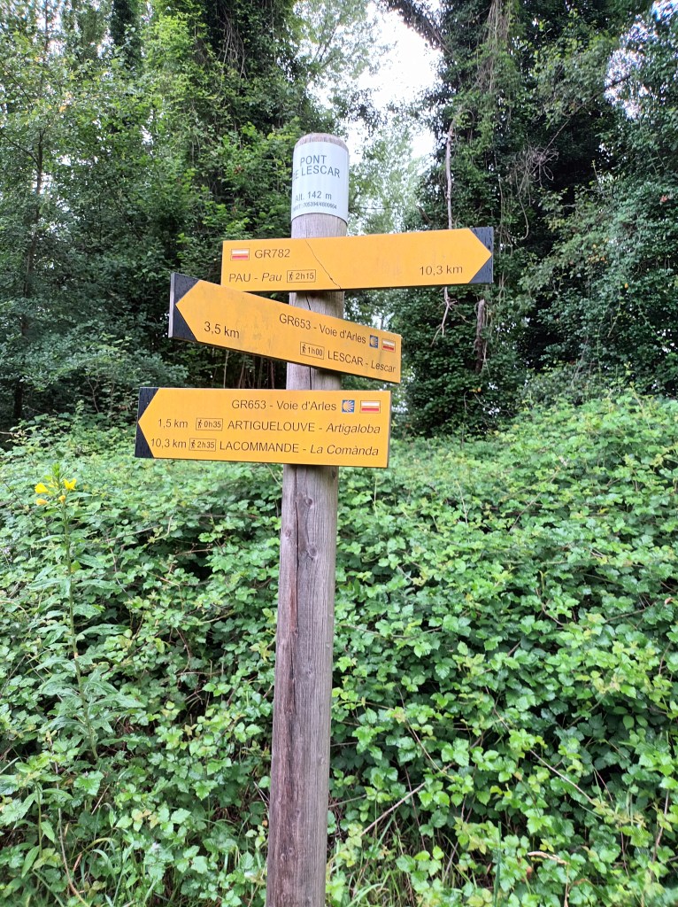
After splitting the easy stage of the Voie d’Arles (GR653) from Morlaàs to Artiguelouve between two hot days, I had found ideal weather for the more challenging continuation to Oloron Sainte Marie: low 20s, overcast, very little rain.
Just as well, as there are no drop-out points served by public transport, so I need to cover about 30 km to Oloron in time for the last train to Pau.
The first part took me from the statue of St James the pilgrim to the pilgrim passage emerging in Lacommande by the medieval buildings where a medieval pilgrim hostel is being restored.
This was quite fast walking, and I didn’t stop for water or even look at my watch until I came to a T junction with no waymarks, which I could not identify on the map and route description in the Topoguide. I guessed wrongly, but found a way via the D road which was not much longer.
Now rather more aware of the need to keep track of where I was, I followed a track into the forest. A rough downhill path made me get out my trekking pole, and when I crossed the road at the Laring valley I discovered that my pace had slowed down.
About 700 metres further on, the track wad blocked by fallen trees. I tried to scramble up the slope, where there were some footmarks, but decided that even if I managed to pass this obstacle there could be others. So, back to the road, hoping that I could get to Oloron that way.
Passing a house, two dogs ran out to me, not threatening but barking loudly. So much so, that their owner called them in. I took the opportunity to ask him if I was on the right road. Fortunately, he was able to point out another path up the hill which rejoined the GR653 where it emerges from the forest.
This brought me to the Heights of Estialescq, and I found a picnic bench outside a house for my lunch break. My watch told me I had now walked 20 km, and the Topoguide suggested it could be another 13 to go. There was a good view looking back over the fields I had crossed, but it was only on leaving the spot that I realised there were even better views, between the houses, in the other direction of the cloud-topped hills beyond Oloron.
A bit further on, there were picnic benches with a water tap and a guest book for pilgrims to write in. Disappointed by the low water pressure, I didn’t bother to get the book out of its box on a tree.
Soon after that, I heard three walkers behind me. They soon overtook. Local people out for a little 8km walk among the hills. After our paths diverged, came the most tedious and discouraging part of the walk, with frequent changes of both horizontal and vertical directions.
At last I came out of the wood and on to the D24 which would take me into Oloron. I looked at my watch. It was 4:30. Now I could stop worrying. I reached Notre Dame church (which I mistook for the Cathedral) as the clock struck 5, went in for a short prayer, and continued to the station, arriving at 17:25 in good time for a beer before the 18:20 train, which wasn’t even the last one of the day.
When I called this post “The next stage”, I realised this could have a double meaning.
Finishing the walk makes me more confident about the prolonged Camino walk a plan for September/October. Perhaps not the Camino del Norte, but something in France: Paris to Le Puy if I can get hold of the guidebook, or the whole Voie d’Arles, from Arles to Puente la Reina.
I made an early start, though not quite as early as I intended, to finish the walk I began last week before the heat of the day. I began where I stopped at the bus stop by the Hippodrome…
… then followed a shady path beside a suburban road until the houses came to an end and the road became a track.
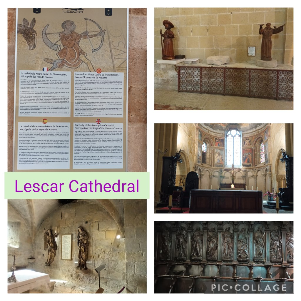
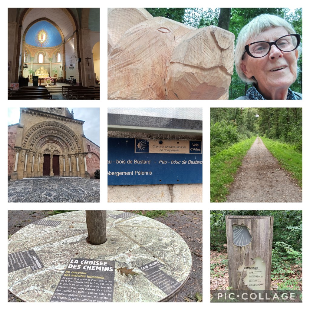
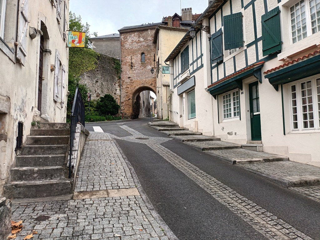
After about 45 minutes I came to the edge of Lescar old town, where a little old man, assuming I was lost, announced his intention of coming with me all the way to Artiguelouve. Fortunately the door of the Cathedral was wide open, and I told him I wanted to spend some time there.
I particularly liked the quiet Oratory Chapel (bottom left) and the wooden statues of SS James and Francis (top right).
By the time I left the Cathedral, the day was warming up, and there was very little shade in the next 2 km. I had walked this stretch in reverse on my way in to Lescar from the river, and it didn’t seem quite as long now I knew where I was going.
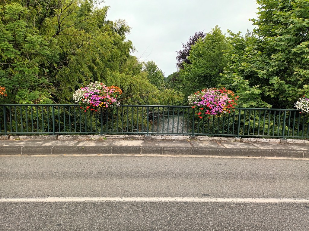
After crossing the river on the road bridge, I returned to the cycle path along its banks, and passed an unusual sight: a timber yard where tree trunks were being irrigated to prevent them bursting into flame.
A tunnel led under a road to a sports field, and I was coming to Artiguelouve. About two and a half hours after starting the walk, I came to a bus shelter. Not the one I wanted, but a good place for a drink of water and an attempt to establish my position on Google maps. All I needed to do was follow the waymarks to the church and turn left to look for the site of the old railway station.
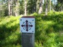
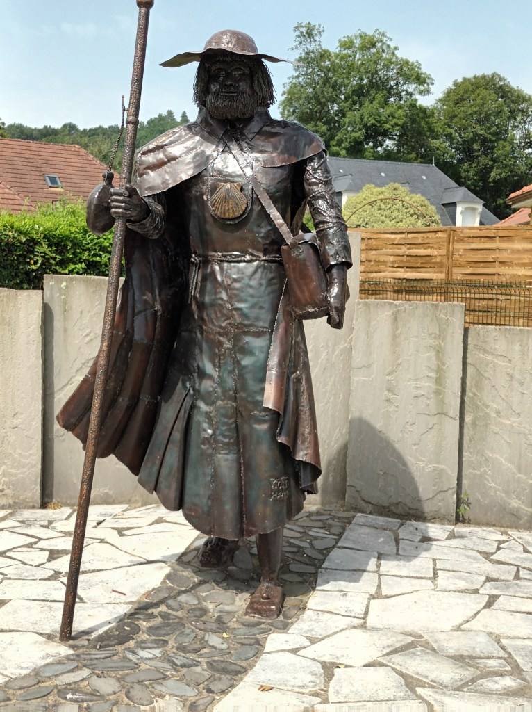
But first I turned right in search of the statue of St James the Pilgrim to gather inspiration for Sunday’s sermon.
And there he is! Now for the bus stop, the end of today’s walk and the beginning of the longer one to Oloron-Sainte-Marie which I hope to achieve before leaving Pau at the end of the month.
Yesterday I planned to walk from Morlaàs to Lescar (20 km) or even Artiguelouve (26 km). In fact, my watch showed 20 km by the time I came to a bus stop, maybe 5 km short of Lescar, and headed back to Pau.
The disparity could be accounted for, in roughly equal shares, by the bus terminus being 2 km east of Morlaàs, non-walking time in church, tourist office and refreshment breaks, and a detour where the route was blocked by fallen trees.
Ste Foy church in Morlaàs has one of those impressive porticos of which I saw many when I walked on the Via Podensis (Le Puy to St Jean Pied de Port). There is a particularly splendid one at Conques, also dedicated to Ste Foy. Maybe the same craftsmen?
The Tourist Office next door to the church was very helpful, providing a step-by-step account of the route to Lescar and photocopying for me pages of a guidebook about the following stage. I also picked up a pocket-sized “Guide du Marcheur” covering the preceding sections from just west of Toulouse up to Morlaàs and giving basic information about accommodation, food and other amenities at each place. A basic, free alternative to Miam Miam Dodo.
All was well as long as the route followed tarmac roads. At the point where one became a stony track, there was a notice “Route Barrée”, and investigation showed that this even applied to walkers. I backtracked to the D road, where I met another walker and told her the bad news. She wanted to see the problem for herself. I never saw her again, so I don’t know if she managed to fight her way through the blockage, decided to give up the walk, or took the same detour as me.
It was easy enough: just carry on the D road to the next turn and, after maybe a km on a minor road, branch off left down a steep hill to meet the official route where it emerges from the woods.
Though overcast, the day was warming up, and I needed a couple of water stops before reaching the Forêt du Bâtard. What a relief! Much cooler, and even a tap to refill a water bottle. I had been here before, in 2017, and parts of the route through the forest and afterwards – footbridge over the motorway and passing the racecourse – were familiar.
Well, I could have continued to Lescar, but chose to leave that for another day.
What does this say about my fitness – physical and mental – for the long Camino walk I was planning in September and October? And if I give up that idea, what would I do with the time I have so determinedly kept free from other commitments?
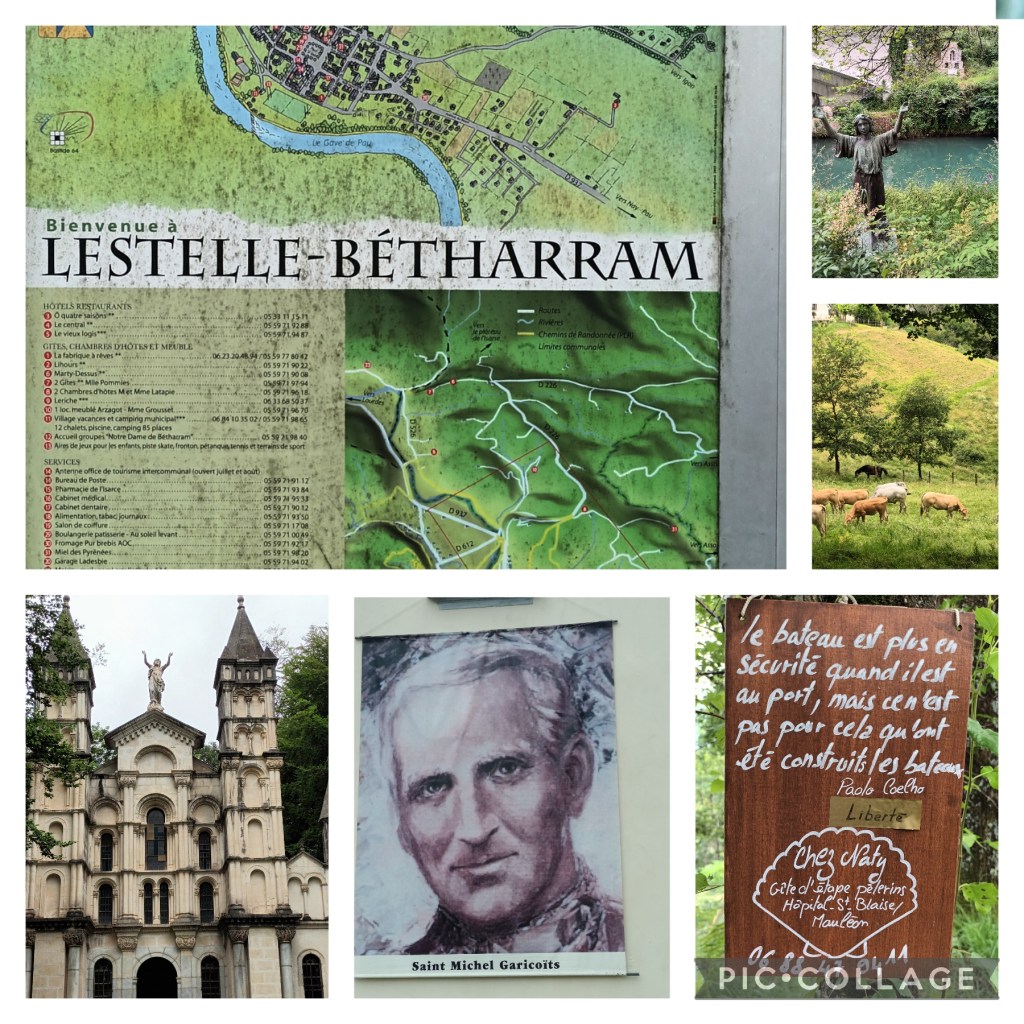
Yesterday I returned to Bétharram, about 32 years after my previous visit when I arrived here on my walk from St Jean de Luz, on the Atlantic Coast, to Lourdes, and, tired as I was, followed the way of the cross on the hillside above the sanctuary.
I felt, then, that I was following the trail of St Michel Garicoits, whose story I first encountered near the beginning of the walk, and whose prayer, “Me voici, Seigneur” (“Here I am, Lord”) became mine. Until, one day, I imagined hearing God reply, “You keep saying, ‘Here I am’ and then go dashing off somewhere. Can’t you keep still?'”
From a poor family, and horrified by the violence of the French Revolution, Michel vowed to become a priest. He was the Director of a Seminary in Bétharram, and I seem to remember reading that he prepared the young Bernadette for Confirmation.
I hadn’t realised that Bétharram was already well known as a pilgrim site – long before Lourdes – following the discovery of a statue by the river bank (top right, in background). The river, as on most of my other walks thus time us the Gave de Pau.
After praying for peace in the Sanctuary, I walked slowly uphill along the Way of the Cross, pausing at each of the elaborate Gothic shrines, to the Chapel of the Resurrection in the photo above, and continued beyond it on a footpath.
I passed some cows enjoying the lush grass and a sign directing walkers to a pilgrim refuge (see top photo again), and continued along a route suggested in a book of rambles in the area. Another walker overtook me with just a “Bon jour.” Not having brought any food, I stopped at a bar in the next village for a draft beer.
The route became a narrow path by a railway line, so muddy in places that my boots are on the point of disintegrating. I managed with the help of a branch picked up on one if the worst stretches, and eventually reached a main road just short of the “Bridge of the Caves”.
The Caves, discovered in the late 19th century, and electrified and opened to the public, were not actually on the route in the book, but I decided I probably had time for a detour. What is there to say about stalactites and stalagmites advancing towards each other at a centimetre per century and still a hand’s breadth apart? We descended about 80 metres to the lowest of the five levels, where the river bed was obvious, and took a boat through a tunnel for a few hundred metres and a tiny train for the remaining 3 km back to the starting point.
This gave me an hour and a quarter to wait for the bus back to Pau, or walk to the village, which I managed with time to spare. The only problem was that the terminus wasn’t where I had expected, but fortunately I walked in the right direction until I recognised where I was.
Three Sundays done, and three to go. Time for another blog post.
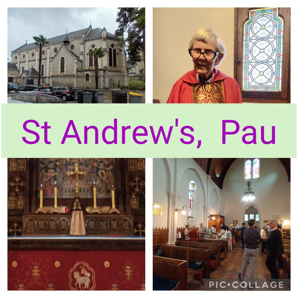
This is the church where I have the honour to serve for the last Sunday of June and the five in July: three commemorating apostles Peter, Thomas and James (hence the red altar frontal and chasuble) and three in Ordinary Time (when the colour is green).
Last Sunday was the only one when I needed to write a sermon from scratch. My written text was based on one verse in the gospel: “Come to me, all you that are weary and are carrying heavy burdens, and I will give you rest… For my yoke is easy, and my burden is light…” Within that verse, I concentrated on the single word, “yoke”, from oppression and slavery in the Old Testament, to Jesus sharing our burdens and calling us to share the burden of others.
It’s a relief to read the covering message from the churchwardens when they send out the recording of the service, and see that they got the point.
On Friday I was invited to tea with David, one of the Churchwardens, and his wife Florenda, in the country near the village of Assat, about 12 km away.
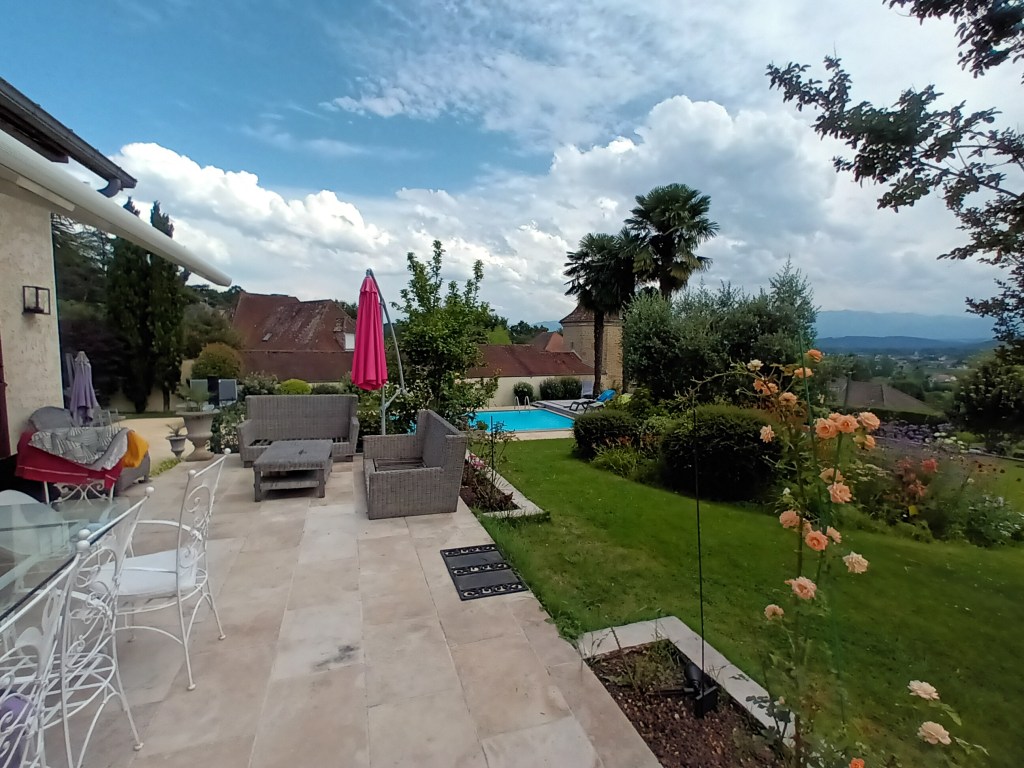
We went for a short walk, curtailed from 8 km to 4 in order to get back to their house before a thunderstorm which deposited two deckchairs into their swimming pool. (The photo was taken before this happened!)
The next day, as previously planned, I walked to Assat, with its decorative bridge over the Gave de Pau, and back to Bizanos on the outskirts of Pau, 20 km. After a climb to the Chateau de Franqueville for the view, the path was mainly through woodland along the river, with occasional sight and or sound of the water.
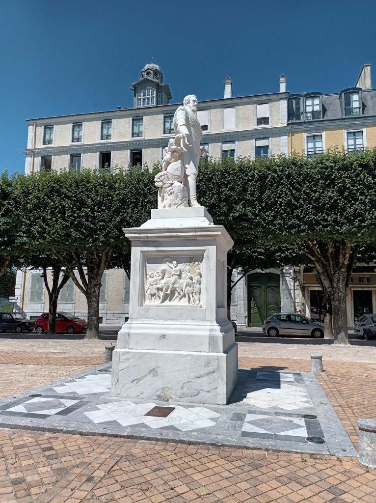
Now it’s Monday, and too hot for a long walk. I signed up for a sightseeing tour of places associated with Henri IV and his family. The other 19 participants knew a lot more about the subject than I did! Here is Henri turning his back on the Pyrenees.
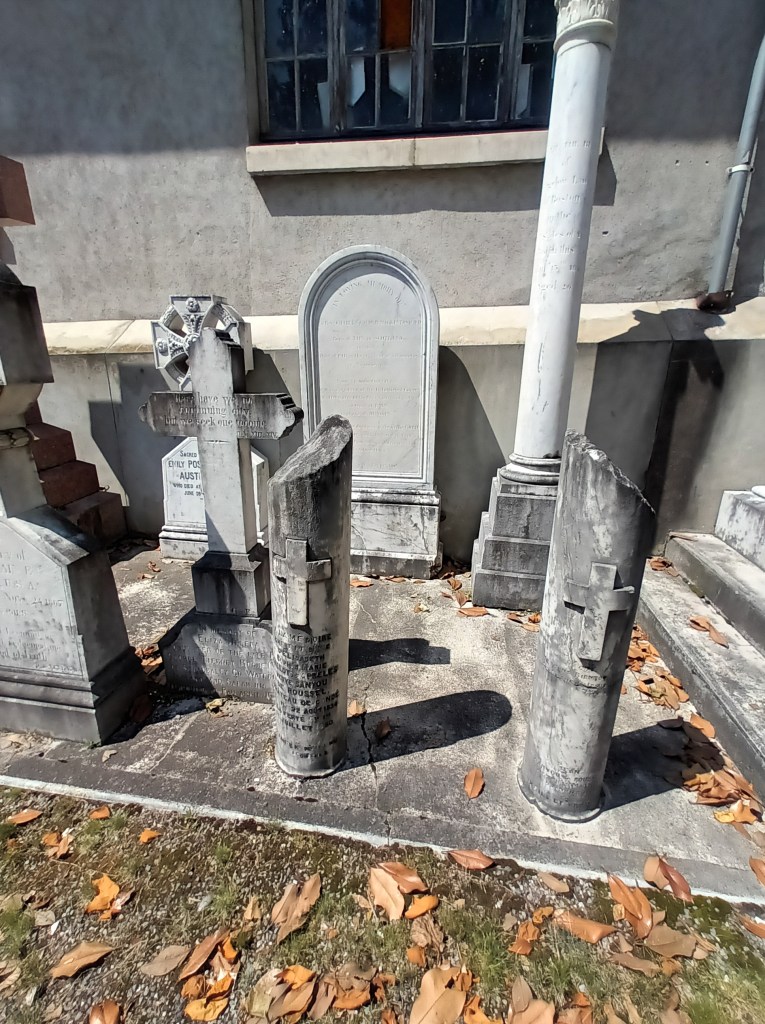
In the afternoon, I visited the English corner of the cemetery, where a number of 19th century graves, possibly some of members of the St Andrew’s congregation, have been restored by the city.
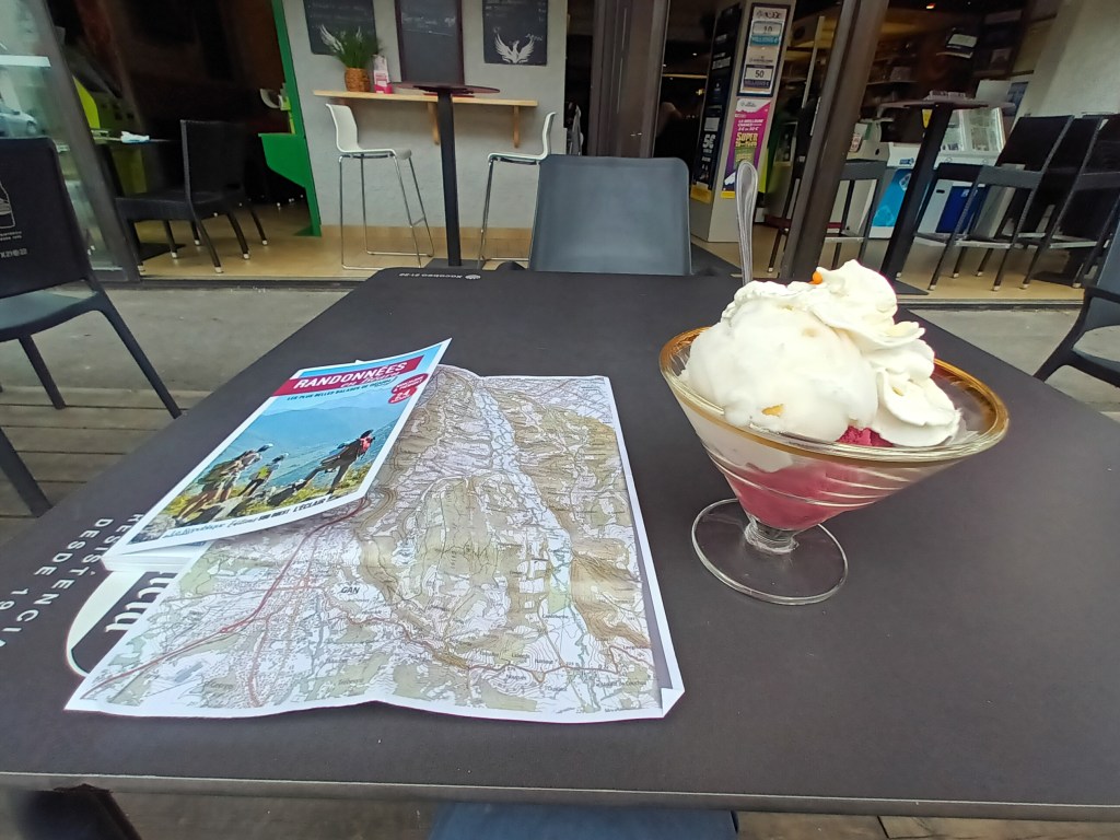
This meant walking back through the Place de la Liberation and stopping off for an ice cream. With 20 flavours on offer, I chose coffee and melon.
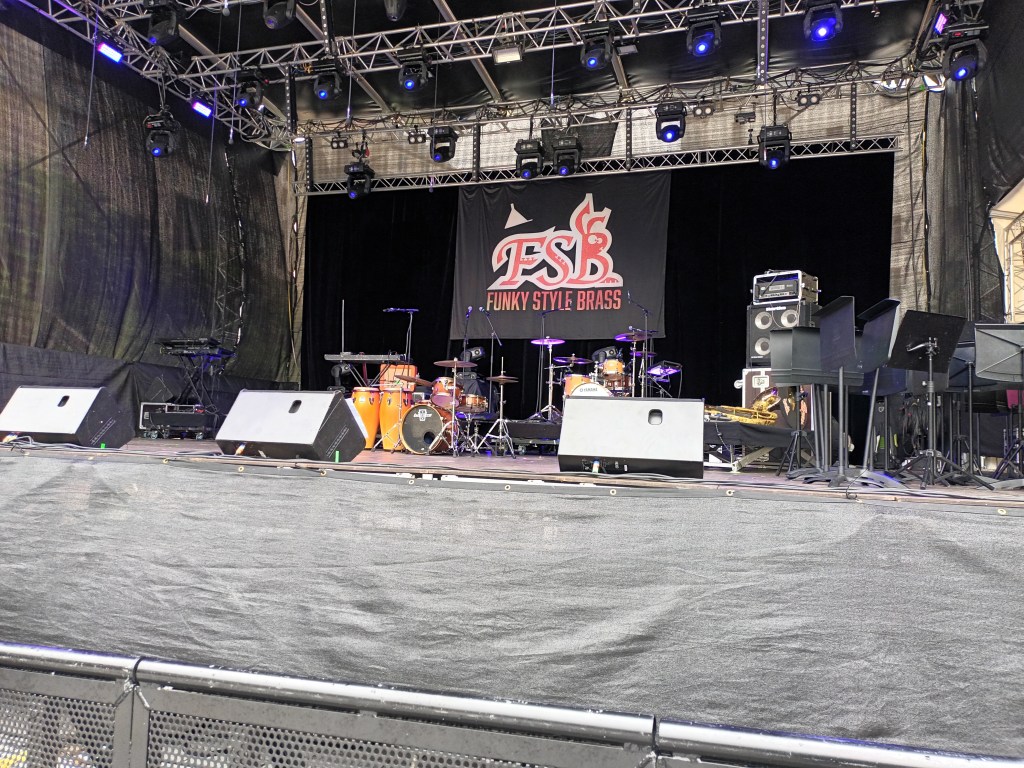
This was a festival weekend: “FESTIVAL PEAUX À PAU”, literally “skins in Pau” but I think it’s a pun. Anyway, there have been free music festivals in Hédas, a ravine running through the middle of the city.
Friday was percussion night with several corners hosting bands of all ages banging anything from drums to glass bottles with different levels of water. Some combined percussion with dance, shaking rattles and tambourines.
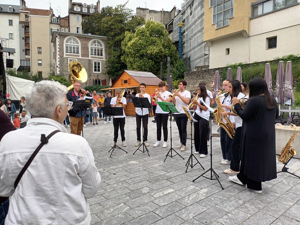
But I didn’t have my phone with me, so I went back on Saturday to take photos. The theme was “Funky style brass”, and this was a warm-up group who started their programme with “We will, we will rock you.”
I didn’t stay for the maim show on the big stage, but this is what it looked like while waiting for the band:
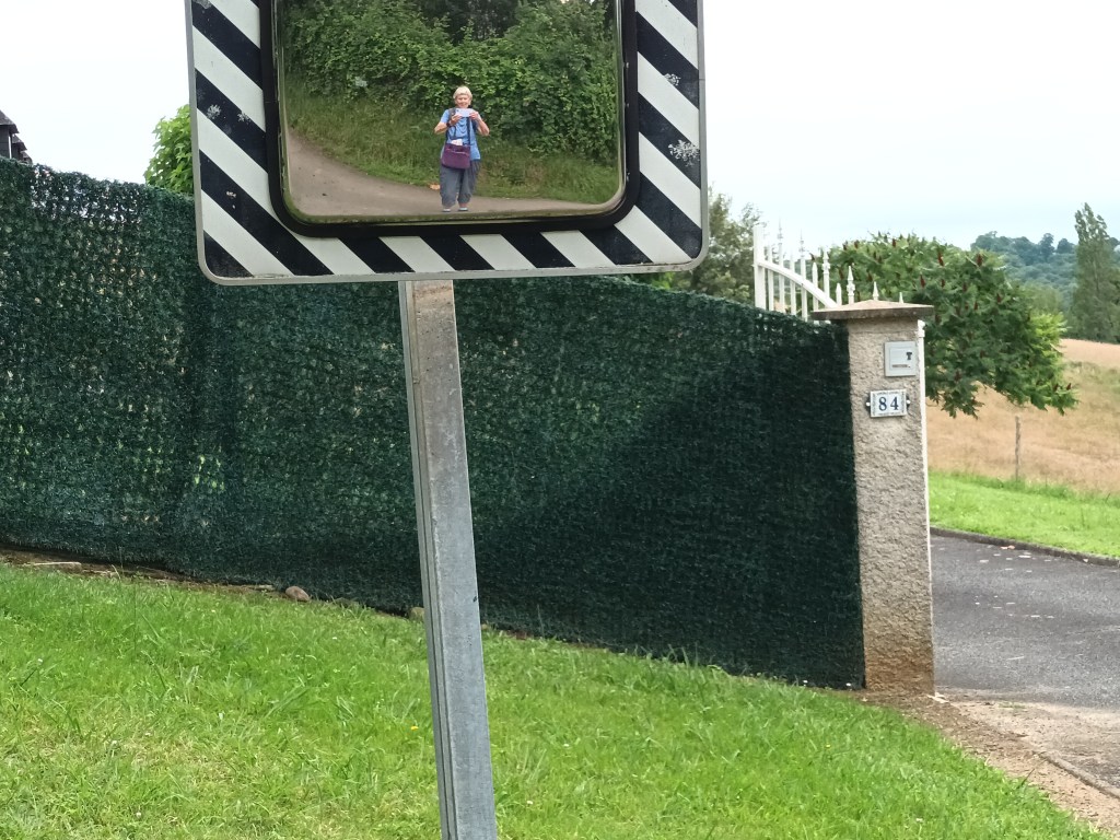
Between my two visits to Hédas, I went for a walk. My intention on Saturday morning was to take a bus to Gan, where they were also supposed to be having a festival, and walk back along a ridge to Jurançon for a bus back across the river to Pau. However, on discovering I would have to wait 45 minutes for a bus to Gan, I decided to do it in reverse.
I hadn’t researched the #1 bus route, and got off at the wrong stop, which took about 3 km to rectify. After that, it was easy to find where the path left the road to go over the first hill and back to the road again. A side road descended steeply to a hairpin bend.
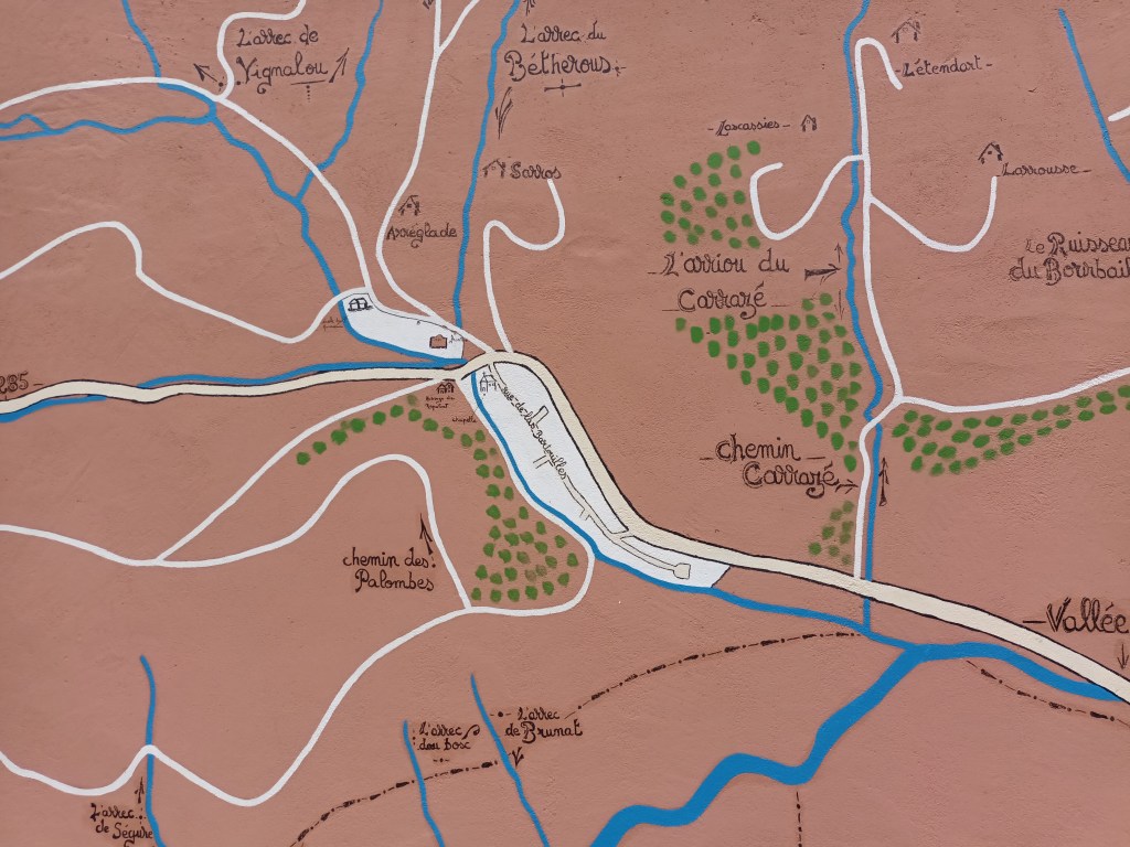
At another hairpin bend, a school had made good use of its pelote wall to make a useful map of the area, making it clear that I should turn left into the woodland immediately after passing the school.
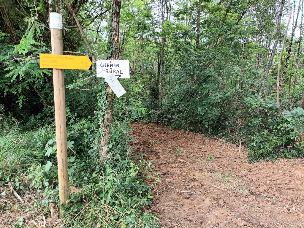
This was a steep and muddy path followed by a broad track churned up by tractors, and then I came to the first footpath signpost seen on the walk.
The path passed a farm with a friendly donkey, and continued along the ridge. Too much vegetation for good views. It became a road, and a turning offered me a “petite randonnée” (yellow waymarks) which looked like the way I had meant to go.
I now know that I should have turned left down a steep path disappearing into woodland after passing a house. But the PR sign said “straight on” and it wasn’t clear to me that the path really was one. So I pressed on, eventually coming to a T junction. I sat on a log for a drink, and was about to consult my map when a young woman came walking along the D road. She told me that, as I suspected, the road did go to Gan, and that it was only about 10 minutes away. I think it was double that!
Anyway, I arrived, crossing a very pretty bridge.
Feeling rather hungry after walking nearly 11 miles, I headed for a restaurant on the main square and asked for the “menu du midi”. I was too late; it was two o’clock and all the food had gone, but they could probably find me a plate of charcuterie. That sounded much too salty, so I asked if they had ice cream. Yes. Lemon and blackcurrant sorbet with whipped cream.
Then it started raining, and, with no sign of festival activity in Gan, I took the bus back to Pau.
What does “Gave” mean? It isn’t in the French-English dictionary, but the “Gave du Pau” is a wide, fast-flowing river on its way to the Atlantic. There was an indication that part of it may be used for white water rafting. But not today!
Having succeeded in joining the Anglophones of Pau-Pyrenees, I signed up for a walk twice round the Lac du Larion, a group of gravel pits accessible from the river bank by the footbridge in the picture.
To make sure I could get there on time this morning, I came out on a local bus yesterday and timed the walk from bus stop to meeting point. I then walked back along the river to Pau, just under 8 km / 5 miles. There is a long distance footpath all the way.
So I reached the starting point this morning with 20 minutes to spare. But no Anglophone walkers turned up! (Could I have been mistaken about the date or time? Would they have rung me if I had given them my English mobile phone number rather than my French number in the flat?
Never mind! 10 minutes after the start time, I set off on one circuit of the lake. There were camping/fishing areas between the wide path and the water. Seeing no point in a second circuit, I returned to the river, and continued north-east to the point where the Riverside path crossed the Camino from Arles to Santiago, GR 653.
I crossed the river on a cycle path beside a busy main road.
Fortunately, once across, a footpath led back to the river bank and later joined a quiet lane into Lescar, a medieval town where many buses from Pau turn around. Arrived in the old town just as everything was closing for lunch.
Well, I’m back here, six years after my last and only previous visit, and for six Sundays instead of three.
The first shock was the prices in the local supermarket, Le Petit Casino. Back home at Aldi, I reckon an average shopping trip works out at £1.40 to £1.60 per item. Here it was 3 €. Admittedly, almost everything I bought I couldn’t or wouldn’t have got in Aldi!
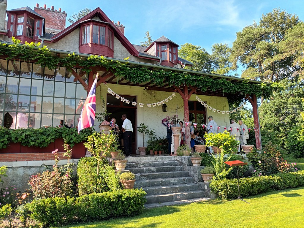
Saturday was very hot, and finished with a garden party where most people stayed in the shade of the house, or indoors.
Garden Party
Yesterday for the service I wore a smart red chasuble – summer weight, but I was glad to take it off afterwards. It then clouded over, but after a busy week I was pleased to stay indoors.
I have spread out maps on the dining table, remembering some of the walks I did last year, and planning some new ones. Some people at church have expressed an interest, and as they have cars we wouldn’t be dependent on public transport. (I was offered the use of a car, but not having driven since 2009 I declined the offer.)
Today Monday it’s overcast and much cooler. Since most shops are closed, it was a good day for a peaceful stroll around Pau, checking out bus and train routes and the location of an open-air theatre and the Museum des Beaux-Arts.
I’ve just been asked to take Communion to an elderly priest, sone time text week. When I was here before, he preached for what he thought would be the last time, and then invited me to join him and his friends for a meal, with wine way beyond my normal budget.
Tomorrow I am interviewing one of the Diocese in Europe candidates preparing for BAP stage 2.
Once more, the forecast on my phone said that it was almost certain to rain every hour. Yes, but not every minute of every hour. The sun shone, and I often turned round to see if there was a rainbow.
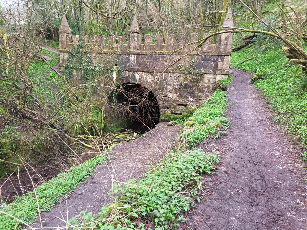
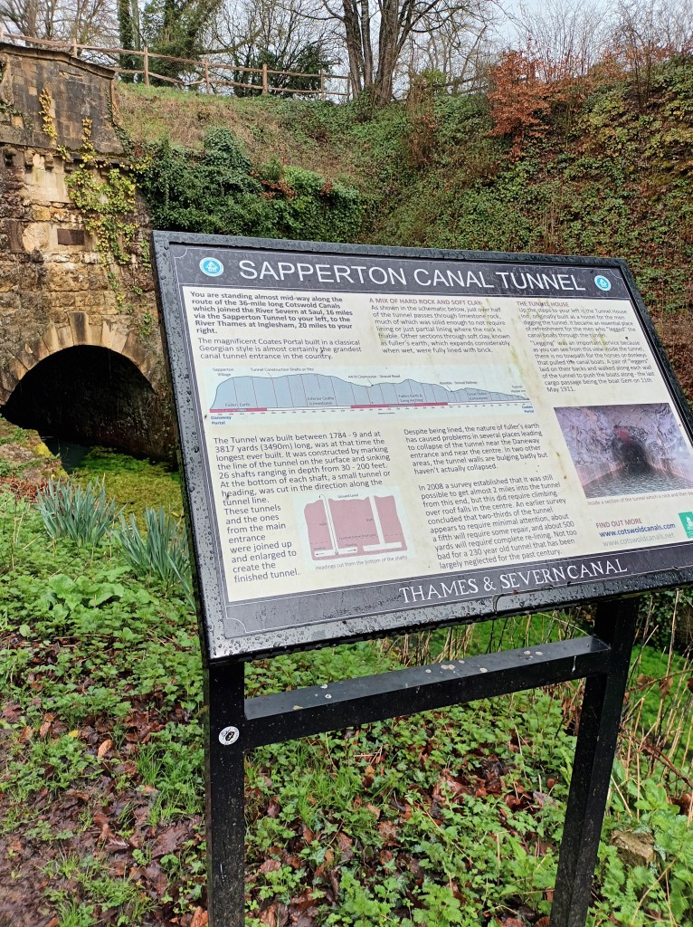
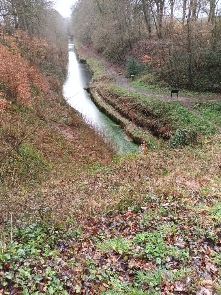
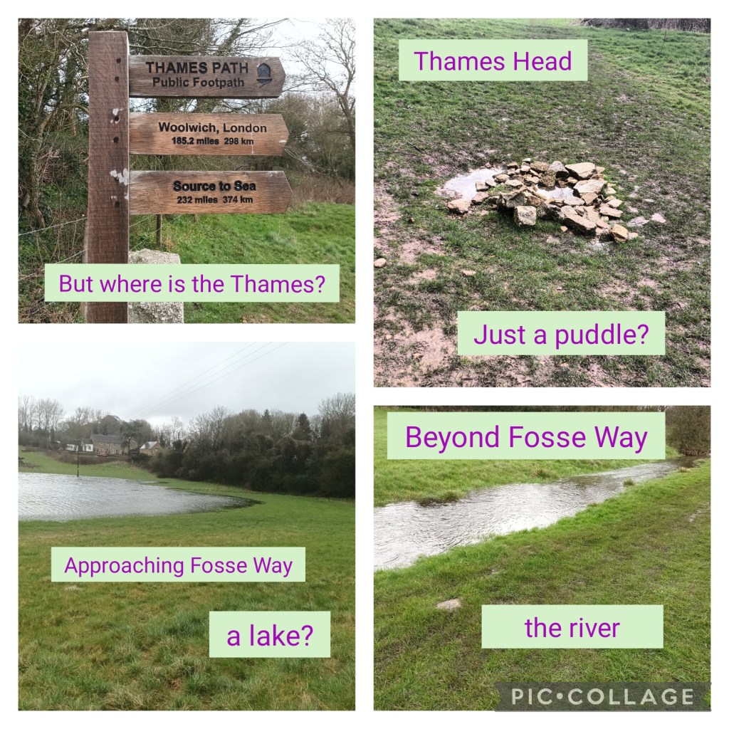
The route followed the Thames-Severn canal, running alongside the river Frome, past demolished locks. At Sapperton, it disappeared into a tunnel, reappearing several miles later, and drying up altogether at a place where the path was covered in puddles every few yards.
Soon after leaving the canal bed, I saw a Thames Path waymark. The supposed source was just round the corner. But where?
A sharp hailstorm then struck, and I lost my connection with OS maps. It was too wet to keep looking at the guidebook, and where I was supposed to leave the Thames Path for Kemble Station, I couldn’t face struggling with another steep stile and soggy meadow. Walking along the road wasn’t much better, with heavy lorries splashing through deep puddles.
With 50 minutes to wait for the next train, I took refuge in the pub opposite, and over a weak and expensive cup of coffee, reorganised my rucksack to make room for wet boots and overtrousers.
As Robert Louis Stevenson wrote, “It is better to travel hopefully than to arrive.” But I did reach the source of the Thames, and there was a visible flowing river much closer to the source than on my previous visit last April.